
I don't know what my aversion is to saying I will keep a blog, then actually KEEPING said blog.
We are presently at a friend's vacation cabin near Bigfork, Montana, on Swan Lake (a smaller sister lake to Flathead Lake). A lot has happened since Minnesota - celebrated my birthday with hurricane-force winds in the Badlands of South Dakota, decided that we weren't doing the Black Hills any justice and skipped up to North Dakota earlier than anticipated, flew across eastern Montana to Great Falls, helped my friends at Malmstom Air Force Base pack and clean their house, then came here to Bigfork.
Writing is hard. I have found it exceedingly difficult for a number of years now. I don't know what it is that prevents me from being as prolific as I was in high school and the first half of college.
But either way, we're here. I rode a jet-ski for the first time yesterday and broke my toe in the process. (I'm a toe-breaker, if you haven't figured that out yet.) This may preclude me from doing much (any) backpacking in Glacier National Park, which is pretty much bullshit - but I am trying to keep my hopes up that my toe will feel great in the morning and will no longer be that ugly red-purple color in a few hours. (Shhh. Don't bust my bubble.)
We aren't sure what our plans are from this point out. We are definitely doing Glacier, Yellowstone and the Tetons, but after that - who knows. We would love to head out to the Pacific Northwest, but Patrick wants to get back to Knoxville to spend time with his kids and figure out his own future, and I'd also like to get back to Santa Fe because my sublettor (who is committed to Nov. 15) said that, if possible, he'd like to move out sooner. He's been a great sublettor so I'd like to help him out with that if I can. Before anything happens, though, we will have to head back to New Jersey to pick up Pat's car and my dog. Then there's always the question of, once I return to Santa Fe, what I will do for money and whether Patrick will eventually follow me out there.
Lots of things are up in the air. But right now I'm just looking out at the storm clouds moving over the lake, wishing I had the energy to write more, but all I really want to do is start reading a new book (finished one today) and eventually take a nap under some down comforters.
Sunday, August 22, 2010
Monday, August 2, 2010
Un-Home
Reporting from a McDonald's in Pipestone, Minnesota. We've spent a few nice days in the Midwest among some of the nicest people in the world. It's true, what they say.
After leaving the UP of Michigan, we went to Patrick's uncle's house in Stevens Point, Wisconsin. Patrick lived for a few years in Stevens Point around the time he first got married, so we drove around time figuring out what was still there after the 15 years since he lived there (and the 10 years since he last visited) and what was long gone. We hung out for a while with his uncle Joe (not to mention his dogs, a lab named Brandy and a truly massive one-year-old Great Dane named Rascal) and his family, and he then informed us that he'd intended to put us up in his stepdaughter's room - but said stepdaughter had come home for an impromptu visit, so he'd like to put us up in a hotel if we wouldn't mind.
Of course we wouldn't mind. So there we were, two nights in a row in a real live hotel. It was pretty much the best ever. I love camping and all, but having our very own bathroom only inches from where we were sleeping? Truly fantastic.
Our stop in Stevens Point mostly consisted of running some necessary errands, eating at Belt's Ice Cream (the "large cone" there is seriously as tall as your forearm and weighs about 4 pounds), drinking at Morey's (where Patrick celebrated either his 21 or 22 birthday - couldn't precisely remember), having a fish fry, drinking Point beer, and various other things that Patrick wants to do one more time in his life. He told me he likes the town, but probably won't be back. You know how ghosts can be.
We bade farewell to Wisconsin and made it to southern Minnesota by Saturday night. We camped the night on Saturday, July 28 in Lake Louise State Park, and last night got to Split Rock Creek State Park on the west end. In between we visited the Spam Museum in Austin, Minnesota - which, dare I say, is the coolest museum we've hit on this trip so far, not to mention it was free - the Jolly Green Giant in Blue Earth, Minnesota (not to mention Sprout at the nearby gas station), and the highest point in Iowa, which is just south of the Minnesota border. The highest point in Iowa is just a little hollowed-out clearing in a cornfield marked with a rock. But there's another high point we can cross off our bucket list! (While we were in Wisconsin, we also scaled Timm's Hill, the highest point in that state.)
At this point we are basically just desperate to get West - and while we crossed the Mississippi two days ago, Minnesota doesn't really feel like it counts. Today we'll finally get over to South Dakota (after we hit Pipestone National Monument in a few minutes), where I feel like the West will finally begin.
Sometimes I like the feeling of not-belonging; like no one place can claim me fully. Home is not home, nor is anywhere else decidedly un-home.
Gitche Gumee
At this point in my life, I have seen all five Great Lakes - though admittedly only the tiny piece of Huron visible as you cross the Mackinac Bridge - and have swam in three of them (Ontario, Michigan and Superior). I've talked a bit before about how great they are, and nothing made me fall in love more than Pictured Rocks National Lakeshore.
Our first full day at Pictured Rocks National Lakeshore, which fell on July 27, we spent mostly driving from site to site, seeing as much as we could. We are based on the west side of the park, and unfortunately, part of the main road through the park is closed (the park stretches about 40 miles along the coast of Lake Superior, from Munising to Grand Marais ). The only way to get to sites on the eastern end of the park is to go way out of the way on a gravel road and approach them from the east. As a result, we put about 200 miles on the car the first day we were there.
In the UP, we seriously got more brochures and maps from various businesses and tourist stops than we have at any location on this trip. The problem, however, is that the information that is on one map may not be on another, but the other map has other information we need - so we ended up shifting mostly between three different maps: One an index of waterfalls and lighthouses in the area; one a forest service map of Hiawatha National Forest and the state forests in the area; and one a map of Pictured Rocks itself. We managed to make sense of it all, however, and spent most of the first day checking out waterfalls all over the park and amassing passport cancellations at various visitors' centers.
The main attraction at Pictured Rocks are the incredible sandstone cliffs on Lake Superior, which often include fantastic wind-swept and ice-carved pillar and arch formations along the shore. The best way, supposedly, to see much of the cliffs is to take a boat ride down the coast - and in Munising, there are also glass-bottom boat tours of shipwrecks, which I think sounds like pretty much the coolest thing in history. But since we're doing this on a budget, we had to skip that. We loved the UP and Pictured Rocks, though, so we plan on going back eventually - and maybe we'll have money that time. Who knows.
Pictured Rocks also had a large dune much like the Lake Michigan Overlook dune at Sleeping Bear Dunes National Lakeshore - the incredible sand cliff dropping 450 feet to the lake - called the Log Slide. It was apparently precisely that in the days that the UP was a logging hot spot - the workers would slide the logs down into the lake. The dune had more vegetation at Pictured Rocks, however, so it didn't have this terrifyingly steep crazy sand-cliff effect like the one at Sleeping Bear did. This one was more like a narrow flume going straight down.
Near the Log Slide (about two miles away) is the Au Sable Lighthouse, which is only accessible by trail; there is no road leading there. It's one of the most remote, isolated mainland lighthouses in the US, and I was really interested in getting out there. They even have ranger tours for much of the week. Unfortunately, it was getting late by the time we finally got there on the 27, and if we'd wanted to go back on the 28, we would burn up a ton of gas in the car going out of our way to get there. So we had to leave Au Sable for the next time too.
Our best time in Pictured Rocks, however, happened the next day, which we dedicated to a hike to Chapel Rock. The trail leads to a waterfall about 1.5 miles into the woods, and then another 1.5 miles past there brings you to Chapel Beach and Chapel Rock itself. Patrick was mostly just desperate to get on a trail and do some real hiking, so we chose the hike mostly because it was there - but what we ended up finding was one of our favorite wilderness spots thus far.
We got a relatively early start, hitting the trail at about 10:30 am. It was supposed to be a cool day, in the 70s, whereas the previous day had been in the 80s, so we figured it would be the perfect day for walking. We got to Chapel Falls, which was pretty and all, but you can only see so many waterfalls in one week. The Pictured Rocks area has almost 20, and while we didn't see them all, we saw a lot.
Once we got past the falls, the trail started slowly descending, and by the time we got near the beach it was a sharp drop-off of about 100 feet where you have to climb down roots and rocks to get to the lake level. When we reached Chapel Rock, it was really impressive. It was a pillar like we'd seen at Miners Castle, but it had a full-grown tree on top of it! Just West of the rock was a large outlet from the woods where the creek we'd seen rushing over Chapel Falls finally reached the lake. It flowed into a large brown tidepool on the beach which was sometimes breached by waves from the lake, but flowed a little to the east and eventually joined in with the lake.
This day, the waves were particularly impressive, probably cresting at 6 to 8 feet! Not only were they large, but as they crashed into the sheer rock face that made up the area around Chapel Rock, I didn't doubt for a second that we were on the shore of a considerably powerful body of water.
Patrick and I sat on the beach for a while, and even though it wasn't very hot, we had both brought our swim suits and knew we had to go in. We took turns hiding in the brush near the beach to change our clothes, then ran into the water. It was pretty cold, but not as cold as I'd expected it to be - besides, you get used to it pretty quickly. The waves were just as strong as those of the ocean, and we found ourselves knocked around and pushed with the current - only we didn't have nasty, briney water to deal with. Only the fresh lake water, which was blue enough that you'd think you were in Bali.
After a while, we retreated from the water and sat on a piece of driftwood to dry off. As time went on (it was a little past noon by now), more and more people started flowing down to the beach. By the time we found a good hiding spot and put our clothes back on, there were probably 15 people on the strip of sand. We started heading back up the trail and, whereas on the way in we had passed a grand total of 3 people on the trail, we probably passed 40 to 50 people as we left. Yet another reason to get your kicks early! Most people on vacation don't want to rouse before 10 am, so if you can get anywhere by 10:30, you're pretty much guaranteed to have any given destination all to yourself.
One thing that I know Patrick and I will have to contend with on this trip is the fact that I don't like to exert myself too too much. Don't get me wrong - I like a challenging hike just as much as anyone else, but sometimes it seems like Patrick feels like he's not doing anything at all unless he's climbing a sheer cliff face or running up a 60-degree incline. I, personally, don't have fun when I'm in pain and uncomfortable, which I don't think so so radical a concept. So while I know I could do any hike if given enough time, Patrick doesn't like to take that time. If he had his way he'd run circles around me the whole way back to the car. But thankfully he knows that would get him slapped.
The Chapel Rock hike was only about six miles, so I can only imagine what I'll encounter once we get further West. Hopefully it won't get ugly.
After the Chapel Rock hike, we returned to the campsite to find it swarming with mosquitoes. The night before had seen the thunderstorm I wrote about earlier, and it brought out ridiculous numbers of bugs. They were biting us right through our clothes. We tried to eat by the light of the propane lantern only to feel like we were sitting inside a giant cloud of monster fruit flies, only these fruit flies wanted to drink our blood. Needless to say, it got pretty old pretty fast and we headed in to bed.
All in all, we loved the UP. The towns were tiny and the people welcoming. Pictured Rocks was an amazing landscape. The tourist traps were fantastic (yes, we went to Da Yoopers Tourist Trap and Museum). We'd love to go back again eventually.
Saturday, July 31, 2010
Pictures 28: Adventuring on the Delaware River
About a week before Patrick and I decided we really needed to get outta dodge, we took what was going to be a day trip to High Point State Park in New Jersey and the Delaware Water Gap National Recreation Area in New Jersey and Pennsylvania. It turned into an overnight camping trip that also included the Upper Delaware National Scenic River in New York.
We got a late start because I was lazy and wouldn't get out of bed, so for a while Patrick was quite cantankerous. He had wanted to do some serious hiking that day, but since I decided not to get out of bed til about 10 am, his plans were foiled. We tried to make the best of the day anyway, but when signage at the Delaware Water Gap was pretty much the worst we've encountered at any NPS site, then Pat pulled a tendon in his calf that he'd pulled a few weeks ago and which was just starting to heal, it was shaping up to be a pretty lame day.
Since we'd gotten such a late start, however, by about 5:30 or 6 pm, we were still tooling around northeastern Pennsylvania and I said... "Do you want to just - not go home?"
We were in Pat's Jeep, which still had all his camping equipment in it. So he said, um, okay. So we drove up to New York and along the upper Delaware on the Upper Delaware Scenic Byway until we found the Ascalona Campground. What the campground is, basically, is the property of an older couple who had a bunch of prime land along the Delaware and decided to do something awesome with it.
By the time we got there, it was probably near 7 pm, and there was a sign on the main office (aka the proprietors' house) that if you wanted to camp, ring the doorbell if it was before 8 pm - or, if it was after 8 pm, just pitch your tent and register in the morning. We rang the bell, and a woman with a heavy European accent came out and greeted us. When we told her we were just driving around and unexpectedly decided to spend the night, she smiled and said that instead of $15 per person, she'd charge us $12. She told us to camp anywhere - the campground was completely empty, but there was a large party coming in the next day, so we had our pick that night.
We drove down to the campsite furthest away from the main building and pitched the tent. We didn't have service at the campground, so we drove a little ways back south on the byway til we got a bar. I called home and told my parents I wouldn't be home that evening and that I'd see them tomorrow. Done and done.
I'll talk a little bit more about camping when the pictures come up...
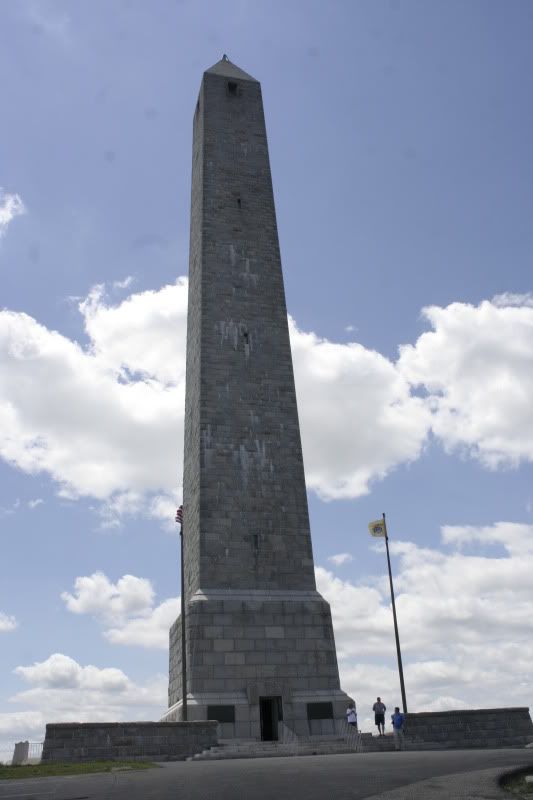
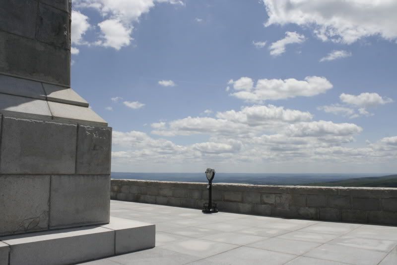
This is the monument at NJ's highest point, which also happens to be right near the northernmost point of the state too.
We really couldn't have asked for a better day, weather-wise.
34 more images below the jump - click any one to make it bigger in Photobucket.
We got a late start because I was lazy and wouldn't get out of bed, so for a while Patrick was quite cantankerous. He had wanted to do some serious hiking that day, but since I decided not to get out of bed til about 10 am, his plans were foiled. We tried to make the best of the day anyway, but when signage at the Delaware Water Gap was pretty much the worst we've encountered at any NPS site, then Pat pulled a tendon in his calf that he'd pulled a few weeks ago and which was just starting to heal, it was shaping up to be a pretty lame day.
Since we'd gotten such a late start, however, by about 5:30 or 6 pm, we were still tooling around northeastern Pennsylvania and I said... "Do you want to just - not go home?"
We were in Pat's Jeep, which still had all his camping equipment in it. So he said, um, okay. So we drove up to New York and along the upper Delaware on the Upper Delaware Scenic Byway until we found the Ascalona Campground. What the campground is, basically, is the property of an older couple who had a bunch of prime land along the Delaware and decided to do something awesome with it.
By the time we got there, it was probably near 7 pm, and there was a sign on the main office (aka the proprietors' house) that if you wanted to camp, ring the doorbell if it was before 8 pm - or, if it was after 8 pm, just pitch your tent and register in the morning. We rang the bell, and a woman with a heavy European accent came out and greeted us. When we told her we were just driving around and unexpectedly decided to spend the night, she smiled and said that instead of $15 per person, she'd charge us $12. She told us to camp anywhere - the campground was completely empty, but there was a large party coming in the next day, so we had our pick that night.
We drove down to the campsite furthest away from the main building and pitched the tent. We didn't have service at the campground, so we drove a little ways back south on the byway til we got a bar. I called home and told my parents I wouldn't be home that evening and that I'd see them tomorrow. Done and done.
I'll talk a little bit more about camping when the pictures come up...

This is the monument at NJ's highest point, which also happens to be right near the northernmost point of the state too.

We really couldn't have asked for a better day, weather-wise.
34 more images below the jump - click any one to make it bigger in Photobucket.
Friday, July 30, 2010
Pictures 27: New Jerseyan Miscellanea
Pat and I spent about two weeks in New Jersey, so I have a few overhanging pictures that didn't really fit into any other category. So here they are.
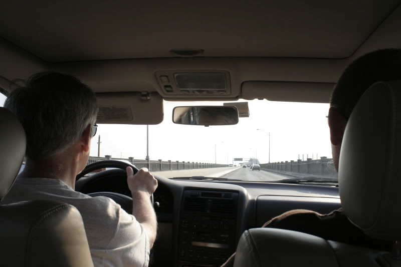

I very rarely get to ride over the Pulaski Skyway - I am usually driving - so it was quite a treat when my dad drove and I got to take pictures out the window of the urban landscape. Of course, the zoetrope-like railing didn't make for very good shots.

See? My dad drives. And Pat rides.
8 more pictures below. Click any one to see it bigger.
8 more pictures below. Click any one to see it bigger.
Pictures 26: Thomas Edison National Historical Park
A very awesome site in New Jersey that I had somehow never gone to before is the Thomas Edison National Historical Park. It includes the labs, prototype factory and home of Thomas Alva Edison, the relatively uneducated inventor who had a hand in inventing pretty much everything you use today, from the electric car to the modern movie studio. There are 1,093 American patents in his name.
Edison was a pretty cool guy, but he was also a bit of an obsessive genius. There is a little bed in his library that he would often use on overnight thinking sessions. He was constantly coming up with new things that could make life easier or, more often, would come totally out of left field and invent something we didn't know we wanted. When he was just a kid in Michigan, he started selling candy and vegetables, and soon became a relative expert at the telegraph. He'd amassed quite a fortune for himself by the time he moved to New Jersey, and he used his wealth to fuel inventing, and used the revenues from his inventions to fund more inventions.
Despite his total genius, he was a weird dude. Since childhood he had a severe hearing impairment, so he often felt awkward in social situations, unable to engage in much conversation. While he was working on prototypes of the gramophone, his horrid taste in music became clear; he often enjoyed shrill vocals and dissonant music because he could actually hear it. He was also stubborn - he worked in his labs until a few months before his death at age 84, and his employees had a personal elevator installed for him so he wouldn't have to climb the stairs. He refused to use it, however (despite a sign on it reading, "For Mr. Edison Only"), and climbed the stairs instead.
I'll babble a few more facts as we go through pictures. Patrick and I went to Edison's Labs on June 20, 2010.
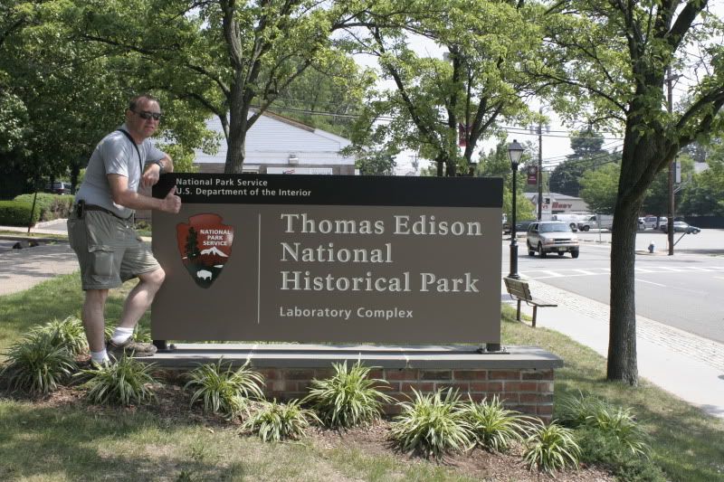
The thumbs-up!
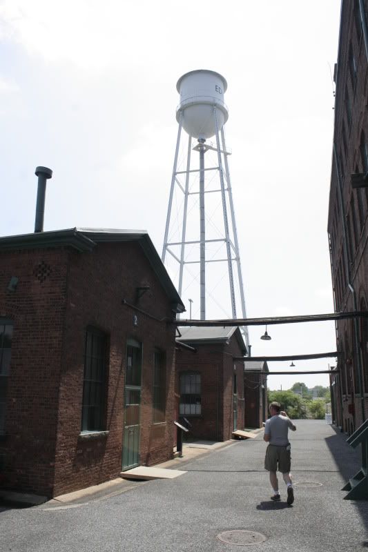
The area around the big brick buildings (which include the machine shop, library, chemistry lab, blacksmith, etc - everything needed to create any invention known to man, basically) is very cool, and feels like you're stepping back in time to when it was a bustling factory.
36 more images below! Click any one to see it bigger in Photobucket.
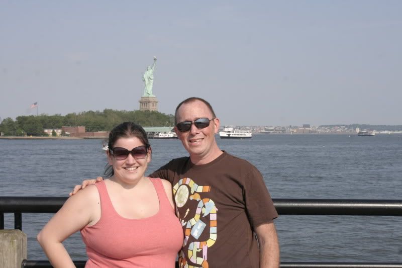
Pictures 25: The Statue of Liberty and Ellis Island
Backing up a little, getting caught up again on photo posts, we venture way back to June 15 to our jaunt into the Hudson to visit the Statue of Liberty and Ellis Island (which, if you want to get picky, are the Statue of Liberty National Monument and Ellis Island National Monument [part of the Statue of Liberty National Monument], both National Parks System sites in New York). Yep, they are part of the NPS, so we got to check a few more off our list of NPS sites to visit!
We decided to go on a weekday because we figured the crowds would be easier to handle - and while we were probably right in some regard, we made the sore mistake of choosing a weekday in June. Anyone with any experience with public schools in North Jersey will know that there are a few places notorious for being the destination of many schools' end-of-the-year field trip, and the Statue of Liberty/Ellis Island is one of them. (Various resorts in the Poconos are other top choices, as are art museums in the city and historic Philadelphia - and once I even went on a June field trip to Amish Country [Lancaster County, Pennsylvania], which was definitely the best end-of-the-year field trip ever.)
So while we missed the weekend crowds, we were inundated with hordes (no, seriously - hordes) of middle-school-age kids bouncing off the walls, screaming, running back and forth, and generally being obnoxious and terrible. I can understand the impulse of taking kids that age to Ellis Island, but you really would be better off taking kids of a high school age to the site - they would probably understand it better and actually read the trillions of text-based exhibits. The kids who were there seemed to have been given a scavenger hunt to find facts and information around the site, but they seemed to better enjoy running from clue to clue than actually learning about what they were finding.
That being said, the first two hours of our jaunt into the river was pretty rough, but once the school kids cleared out just after lunch time, things quieted down and we were left with mostly fellow adult tourists, which I can deal with much easier.
A few words to the wise about visiting the Statue of Liberty (which I always want to call "Shashoo Liberty" for some reason) - book your ferry tickets early, your pedestal tickets earlier, and your crown tickets months in advance.
You must take a ferry to get to Liberty and Ellis Islands, of course, but many people (including me!) don't realize that you need to advance-purchase tickets to the observation pedestal under the statue (they are typically sold out one to two weeks in advance), and if you want to climb all the way up to the statue's crown, those tickets need to be bought three to six months in advance. Crazy! I don't know why I didn't realize these things, but at least we were able to get ferry tickets online ahead of time.
So, without further a-blah-blah, here come some pictures. I am starting out with pictures from the visit my dad, Patrick and I took to Liberty State Park the day Patrick arrived in New Jersey.
I like this one.
26 more images below; click any one to make it bigger in Photobucket.
We decided to go on a weekday because we figured the crowds would be easier to handle - and while we were probably right in some regard, we made the sore mistake of choosing a weekday in June. Anyone with any experience with public schools in North Jersey will know that there are a few places notorious for being the destination of many schools' end-of-the-year field trip, and the Statue of Liberty/Ellis Island is one of them. (Various resorts in the Poconos are other top choices, as are art museums in the city and historic Philadelphia - and once I even went on a June field trip to Amish Country [Lancaster County, Pennsylvania], which was definitely the best end-of-the-year field trip ever.)
So while we missed the weekend crowds, we were inundated with hordes (no, seriously - hordes) of middle-school-age kids bouncing off the walls, screaming, running back and forth, and generally being obnoxious and terrible. I can understand the impulse of taking kids that age to Ellis Island, but you really would be better off taking kids of a high school age to the site - they would probably understand it better and actually read the trillions of text-based exhibits. The kids who were there seemed to have been given a scavenger hunt to find facts and information around the site, but they seemed to better enjoy running from clue to clue than actually learning about what they were finding.
That being said, the first two hours of our jaunt into the river was pretty rough, but once the school kids cleared out just after lunch time, things quieted down and we were left with mostly fellow adult tourists, which I can deal with much easier.
A few words to the wise about visiting the Statue of Liberty (which I always want to call "Shashoo Liberty" for some reason) - book your ferry tickets early, your pedestal tickets earlier, and your crown tickets months in advance.
You must take a ferry to get to Liberty and Ellis Islands, of course, but many people (including me!) don't realize that you need to advance-purchase tickets to the observation pedestal under the statue (they are typically sold out one to two weeks in advance), and if you want to climb all the way up to the statue's crown, those tickets need to be bought three to six months in advance. Crazy! I don't know why I didn't realize these things, but at least we were able to get ferry tickets online ahead of time.
So, without further a-blah-blah, here come some pictures. I am starting out with pictures from the visit my dad, Patrick and I took to Liberty State Park the day Patrick arrived in New Jersey.

I like this one.
26 more images below; click any one to make it bigger in Photobucket.
Wednesday, July 28, 2010
Yoopers
Sleeping Bear Dunes National Lakeshore was nice and all, but now that we have visited Pictured Rocks National Lakeshore on the Upper Peninsula , we are Yoopers for life.
But I’m getting ahead of myself.
After waking up dew-covered in our thistle field outside Empire, we packed up the car and headed out in search of coffee and the road north. Neither of us had ever been to Michigan ’s Upper Peninsula , so we were eager to get there.
We opted to take the scenic route along the shore of Lake Michigan Sturgeon Bay
Soon, though, it was time to bid farewell from the lower peninsula that we’d called home for more than a week. We crossed the Mackinac Bridge
Other than the aforementioned dude who cursed at me as we bottlenecked into the toll booths – and by “He cursed at me,” I actually mean “I cursed at him” – (and the toll was only $3.50! We were counting on $10-$15. Welcome to the West), our experience of the Upper Peninsula has been nothing short of paradise. A slightly buggy paradise, but paradise nonetheless.
We were pretty amused by the tourist trap that is St. Ignace, the city you encounter right when you cross the bridge. Actually, we are pretty amused by every town on the UP, because if there’s something resembling a town here on something resembling a modern road, it does its absolute best to sell travelers “real Yooper gear” and pasties (which is pronounced “pass-tees” – NOT like the burlesque dancer’s nipple-cover) and fancy UP minerals and rocks.
We stopped at the “Mystery Spot,” which advertises itself as just that until you get into the parking lot and finally get a chance to actually read a little sign about what the Mystery Spot actually is. Apparently it’s one of those strangely-magnetized places (there are a number of them scattered around the country) where navigation tools cease to work, levels won’t level, people feel woozy, all that kind of stuff. This spot offered $7 tours (to which I say: “Why would I want to pay $7 to feel light-headed?”) and a little shop full of tchotchkies for travelers. Right near the Mystery Spot is the Deer Ranch, which we stopped at mostly to take our picture in front of the giant fiberglass deer out front (we didn’t go in to see the billions of albino deer the site claims to have living there).
When it came time for lunch, we knew we had to try the magical local cuisine known as the pasty. It’s essentially a pastry filled with anything you can imagine (everyone claims some different concoction is the “original” recipe) and formed freestyle with no dish to shape it. We stopped at Lehto’s, a little stand on the side of the highway that sells nothing but beef and onion pasties and cans of soda. But the place has been there since 1947, so we figured it had to be pretty good, right?
We were right to stop there. The guy behind the counter (yes, one guy – and I think there was one person back in the kitchen, and that’s it. No restrooms, no credit card machine, nothing but beef pasties) was really nice, and the pasties were fantastic. It was hot out, and the pasties were hot enough to burn our mouths, but they were the perfect size for a modest lunch for one person (but that didn’t stop me from wanting another one when I was done).
The further we got from St. Ignace, the more nothing we passed. It didn’t take long at all for the motels and clusters of vacation cabins to turn into miles upon miles of pine trees and the occasional abandoned cluster of vacation cabins. At Epoufette we cut north on a county road so that we could take a short drive through Rexton.
My sophomore year of college, I wrote a short story about a girl from Long Island who travels to visit family in Rexton , Michigan
Rexton was not exactly as I’d pictured it for my story, and upon going back to read the story I would probably have to re-tool the landscape descriptions (I don’t remember exactly, but I probably talked about barns and farmhouses and fields like I’d seen in Dexter – but in the UP it’s all just trees and more trees). But overall it was great; a small cluster of houses, a couple streets, a Mennonite church (how perfect! If I ever go back to edit the story I will totally make the family Mennonites), and… That’s it. Most of the houses were tiny run-down saltboxes like you find all over the UP – not much more than a trapper’s cabin updated to have shingle siding and a screen door. Those that weren’t saltboxes were mobile homes from the ‘70s with particle board patches on the outside. There were a few houses that were a little nicer, and I figure that’s where my characters would have lived.
Driving through a town like Rexton, Pat and I were struck again by the question of how in the world people in areas like that could possibly make any money. Some of them probably live on public assistance, but the rest – seriously, where? There were a few companies floating around the roads we drove, like a granite company and a concrete company, but other than that – nothing. Even if someone needed the plumber we saw to fix their pipes, where would the person with the pipes get the money to pay the plumber? I’ve never lived in a tiny town like those so I have no clue – I mean, I live in a tiny town now, but it’s only 26 miles from the state capitol and 50-ish miles from the state’s largest city. These places on the UP don’t have much by way of a nearby metropolis.
We managed to get to the main interagency visitor center for Pictured Rocks National Lakeshore and the Hiawatha National Forest Hiawatha National Forest
She replied, “You can just drive your car down any of those roads and camp, as long as it’s forest land.”
Um… We know. But are there any good places in particular?
“Oh, any of those roads.”
Okay.
We figured she wasn’t going to be much help (she didn’t look like much of a camper herself), so we decided to fend for ourselves. Our main concerns were finding water – we were very low on drinking water, and while Patrick has a water filter, we didn’t want to use it if we didn’t have to – and getting me a shower or some other manner of bathing, because it was now Monday and I hadn’t showered since Saturday morning, and I’m a bit of a hygiene freak.
We got in the car – Patrick a little irritated at our lack of specifics, me a little irritated that I was so filthy – and set off down H13 to find us some camping.
After trying a few times to go down roads that we thought would end up at bodies of water, only to find them dead-ending or impassible, we had our first indication that things were going to be okay. We found some water relatively easy. We took a detour off 13 to the Island Lake
We smelled it, and it smelled like metal, so we knew it was just rust. Pat’s water filter would take care of the crap in it (but, as we found later, not the taste).
The campground was primitive, with no more facilities than that one brown-water pump, yet it was $16 to stay a night – oye! I mean, I know the forest service isn’t exactly rolling in dough, but that’s a lot of money for a place to pitch a tent and some rusty water.
We continued on and turned down a road that led to a strange swampy-looking place that wasn’t a swamp at all. It was a large expanse of tons of dead trees poking up out of ground that looked like it was covered in marsh plants, but when you walked into the field you realized the ground was actually sandy, and the “marsh plants” were actually ferns. We didn’t figure out why all the trees were dead, but it was pretty strange.
We drove down the road a ways, having no luck finding a place to camp, not to mention any water. Soon we saw a big pickup truck with a trailer behind it was coming our way on the one-lane road, so we pulled off the road to let it by.
The truck stopped, though, and a smiling forty-something man with a bandana leaned out the open window.
“You lookin’ fer blueberries, eh?” he asked.
“No, just trying to find some camping,” Pat said from the passenger seat. “Know of anywhere around here? Maybe on a stream?”
“No… No, no streams in this area,” he said. “I’m just out here choppin’ some wood.”
Somehow, both Patrick and the man got out of the cars and began talking, and when Patrick pulled out a map and told the man what we were looking for, he said, “Oh, yah! Yah, go down 13, and you’ll see Wide Waters on the right. Right there on the left, there’s a road, and then it will come to the Indian River . Turn right before you get to the river and there’s a road there with all offshoots to the right where people cut roads and campsites to put their canoes in. People camp there all the time.”
Bingo!
This was exactly what we wanted from the woman at the visitor center. We should have known to just ask a Yooper.
We hung out with the man for another few minutes, asking him how to find blueberries. He told us about how, when he was a kid, his family was very poor, so he and his siblings would all go out picking blueberries – then their father would sell them, and fed the whole family on blueberry money. He said the only problem with camping near a blueberry patch was “the bears and the cah-yoots.” He told us that he’d be picking blueberries, and he’d look up and not ten feet away a bear would be doing the same. But he knew he wasn’t in much danger – “the blueberries were sweeter than me.”
He brought us to a little bush on the ground, and it was just like the blueberry bushes we’d pick from as kids in Bass River State Forest
We thanked the man and I thanked the powers that be that Patrick is as nice as he is. For some reason, I have been more hesitant lately to talk to strangers – but Patrick isn’t, and many times on this trip he’s gotten us tips that I never would have gotten by simply smiling and going on my merry way. I have never been good at asking for help, but recognizing when you need it is one of the most important life lessons you can learn – especially while traveling.
We followed the man’s directions and, sure enough, the first campsite we stumbled across was beyond perfect. About 150 feet in from the road on a slightly bumpy little rutted sand driveway was a site with a trim stone fire pit and a steep eight-foot-ish embankment down toward the river. We went and looked at another few sites, but realized we weren’t going to find one this nice anywhere else.
We pitched our tent and this has been our home for the last two nights, and will be our home tonight again. I almost don’t want to leave in the morning.
My first order of business upon arriving was to take a bath in the river. The Indian River is actually pretty deep – probably four feet deep at its lowest point near our campsite, with a beautiful clean sandy bottom and a swift current of clear water the color of the weakest cup of tea you’ve ever brewed. I picked my way down the bank to a spot where a bunch of large stones rested in the water, forming a perfect stairway down into the water, not to mention a little shower seat and a place to put my soap while I washed up. The water was warm enough and the spot secluded enough that I took my time, even shaving my legs. It was far better than a campground shower any day.
That night we turned in relatively early. There was a whipporwill off near the road that sounded just like a car alarm and went off most of the night. Sometimes, in half-sleep, I could swear that I had distinguished two birds, calling and answering each other in a rapid and perfect pattern of whoops, never stumbling or hesitating for hours and hours on end.
Great Lakes III
I had to cut that last post uber-short last night because it started to rain. After a few little drops on my laptop screen, it continued to rain until Pat and I were in the tent during torrential downpours and ridiculous red lightning bursts that lasted for what seemed like hours. I laid there on my back and watched as first the tent ceiling would flash, illuminating the poles and seams, then it would go dark and the pattern would show up in negative, only to have lightning flash again a second later and the negative would float again. I realized during the storm that you could probably drive a car perfectly fine in the storm; it was only ever dark for a split-second at a time – the rest of the time it was bright as day.
So anyhow, that is what kept me from writing all this down last night.
Now I am dressed in bug-resistant garb and the sky is blue, so there will have to be some other less-expected occurrence for me to cut THIS post short.
We got to Sleeping Beat Dunes National Lakeshore on Sunday, July 25, and expected to be able to find camping in the primitive campground at the park. We rolled into the park relatively early in the day, counting on the few walk-in sites that campgrounds tend to reserve for same-day reservations, but found that we were too late anyway. All the campgrounds were full.
Pat got irritated and said we should just say screw it and head to the upper peninsula. I told him to shut up and that we’d find a campsite just fine – there were state forests all around Sleeping Bear Dunes and we wouldn’t have a problem finding a backcountry site.
First we tried calling a campground in Garey Lake State Forest to see if they had any sites available, but the state forest offices were closed so no one answered. Instead, we went to the road that the campground was on, a small dirt forest road outside the town of Empire
On forest roads like those, there are often private residences and properties interspersed within the state or national forest, and property owners are often vigilant with “POSTED” signs along these roads to discourage people like us from camping there. Along this road we saw a few signs like that, including a few offshoot roads that were clearly marked as private drives. We also saw, however, a number of Michigan
We drove along the road a ways until we found an offshoot road that was not labeled as a forest road, but was probably cut by other campers in the area because it led somewhere particularly nice. We turned down it, and in less than a quarter-mile we ended up in a beautiful field of thistle ringed by pines. We got out and investigated the road; ours were the only recent tire tracks, and we looked all over and couldn’t find any POSTED signs. Our best guess, then, was that the land was state-owned, and that we could camp there.
After we’d staked out that nice spot, we got back in the car and headed back to Sleeping Bear Dunes to explore.
The story of why the area is called Sleeping Bear Dunes strikes me as particularly sad. It’s printed in all the park brochures and has probably developed a trite and convenient tone to people who work or live in the area, but for a tourist like me, it rings new enough to be effective and touching.
An old Anishinaabek Indian story says that a long time ago, in what is now Wisconsin , a forest fire drove a mother bear and her two cubs out of the forest and into Lake Michigan . They swam all night, but eventually the two cubs began to tire. The mother bear finally made it to the other shore, but the cubs succumbed to exhaustion and drowned just before reaching land. The mother bear lay down on the dunes to wait for her babies. The Manitou turned her into The Sleeping Bear, a prominent dune, and then created the two Manitou Islands
There are a lot of little stories like this to describe land formations all across the country, but usually they honor heroes or legends or particularly powerful beings. This story, unlike many others, I found particularly sad because it describes a mother who will never be reunited with her babies. As I read the few sentences in the brochure I expected a happy ending – that the cubs made it and they were happy and lived to old ages and eventually went to govern the islands that were created to commend their bravery. But it wasn’t like that.
All in all, the park was nice – you just don’t get massive dunes like this except for on the coasts of the Great Lakes . The beaches there were just as nice as any I ever visited in New Jersey Glen Haven Historic Village
To get to the latter, you have to go from a parking lot and down a huge dune to get to the beach – and when it came time for us to pack up and leave, I just didn’t feel like climbing up the huge dune again. Thankfully, since Patrick is ridiculous, he said he’d be happy to take a jog up the dune, get in the car, and meet me about a quarter- or half-mile down the beach at the Coast Guard station/maritime museum. Perfect. So I meandered down the shoreline and Patrick brought the car around and everyone was happy.
After swimming and driving around the park a bit, we were tired but not quite ready to end the day – not to mention we didn’t want to break out the camp stove and make dinner at our state forest campsite, just in case it was someone’s private property and they smelled the mysterious aroma of ham coming from their thistle field. So we went over to the Pierce Stocking Scenic Drive Sleeping Bear Dunes State Park Glen Lake
You get the perfect sense of just how huge the dunes are. As approached the edge of the dune, it basically looked like the sand dropped off at a sheer cliff 450 feet above the lake. The sun was beginning to set when we got there, so it was casting a blinding shine over the water. As we approached the “edge,” we saw that it was actually a steep dune that ran all the way down to a narrow beach at the lake – the angle of the dune must have been 60 degrees. People were still trying to clamor up and down the hill. I just don’t see the appeal – the view is totally spectacular from the top, and once you get all the way down there, you’re on a beach like any other… And then you have to climb back up 450 vertical feet in loose, hot sand. Not my idea of fun. But there were a bunch of people doing it, most of them kids who I bet slept really well that night. I guess it’s worth it to say you did it, but I can say I did a lot of other cool things that didn’t cause so much physical pain.
After the scenic drive, we returned to the campsite to find it just as deserted as we’d left it. We parked the car and explored the outlying land a little – we heard a dog barking off in the woods and the occasional car drive down the main road we’d come in on, but other than that – and a conspicuously newly-planted tree surrounded by chicken wire – we were completely alone.
Being so totally alone again in the woods, after spending two nights with Tom and Mikki and a week before that in Michigan and two nights before that in Columbus, was particularly sweet. Pat and I function in a lot of the same ways, take comfort in a lot of the same things and enjoy much of the same activity – so we spent the evening enjoying each others’ company, reading, making jewelry and, eventually, getting a fantastic night’s sleep (despite some suicidal bug that buzzed and thrashed itself against the outside our tent for the better part of the evening). The sky, of course, was lit by residual sunlight until after 10 pm, and in the morning when we woke everything was soaking wet with dew, but that’s part of the package.
Tuesday, July 27, 2010
Great Lakes II
I had to cut that last post short last night because the mosquitoes were driving me up the wall. Everything they say about mosquitoes on the UP is true. If you come up here, ever, do NOT forget your bug spray.
Monday, July 26, 2010
Great Lakes I
We are camped on the Indian River in Hiawatha National Forest on Michigan ’s Upper Peninsula . So far it seems like everything they say about the UP is right – the mosquitoes fly in flocks, the water is crystal-clear, and the people are just about the nicest on earth. Except for that guy who cursed at me at the toll booth as we crossed the Mackinac Bridge
We left Dexter on Friday in order to spend Friday night at Tom and Mikki’s in Clio. The next day, Saturday, we got a bit of a late start (Patrick and I like to usually be on the road by 10 am at the latest – but we didn’t leave Clio until 1:30 in the afternoon). With Tom and Mikki following on Tom’s Harley, we crossed the lower peninsula’s countless miles of farmland via two-lane roads until we reached the Ludington area on the shore of Lake Michigan , in Manistee National Forest
The campgrounds at Manistee are around $12, which means you get prime real estate near the roads and paths to the beaches, plus running water and a hardly-bearable bathroom. To camp in the “backwoods” (aka, 150 feet off a road) is free – and peeing in the woods smells a lot better than peeing in the bathrooms they had there. We’d planned on backwoods camping anyway, but it was nice to see just how smart we were when we pulled a little bit off a main road to find a sprawling campsite complete with fire pit.
Since we have two tents (one 4-man tent for car camping and one 2- man tent that we’ll use once we do more backpacking), we set up camp with two tents and, before it got too dark, the four of us headed down to the beach to take in the lake.
After visiting the Great Lakes again, it’s hard to understand why anyone would want to live near an ocean. I mean, don’t get me wrong – I’m a Jersey girl through and through who wouldn’t give up the shore for all the freshwater glacial lakes in the world. But seriously, these lakes are gorgeous, and you have none of the nastiness associated with oceans to go along with them – no salt air, no smelly fish, no rancid low tides. Just clear water, silky sand (in most places, that is) and, yes, waves.
We walked down the beach at Manistee for a while. I mostly lagged behind taking pictures while the three of them wandered ahead. I wandered into the waves mid-thigh and hardly noticed – the lake was warm as bath water. The water was this fantastic clear blue-green-brown color – almost like the color of a pale beer bottle or an old telegraph insulator. The little waves crashed on the pebbles and sounded like wind chimes.
It was strange camping with people other than just the two of us. The more people we meet and spend time with – especially on this trip – the more Patrick and I realize that, despite our obvious differences, we have a lot more in common with one another than we differ.
We’re both really quiet people, we’ve found – like right now, Patrick is off making macramé jewelry in the campsite and I’m sitting here writing. Sometimes we go hours at a time in the car with no music. We speak only as loud as is absolutely necessary to be heard. I think I used to be a much louder person than I am now (well, I know I was) – but something clicked in me a few years ago that made me shut up and open my ears. I think I have learned a lot more this way.
We’re also both relatively goody two-shoes. We were laughing the other day that pretty much everyone we know smokes or otherwise ingests pot – except us. We’re the last people on earth who have no interest in it. So it’s nice that, wherever we are, when everyone wants to offer us pot at every turn, we both say “No, thanks.” It would get really old really fast if one of us smoked and the other didn’t. And if both of us smoked, we’d be really broke by now.
Here’s an important one: We’re both very clean. Being on the road, it’s not easy to be spotless all the time, but I’m a hygiene maniac – so if I’m not totally freshly showered and laundered and perfect, I have very good ways of hiding it so everyone thinks I am. We wash dishes obsessively and with the scrubby side of the sponge. Every other night or so Patrick will almost completely unpack the car, tidy everything up, and re-pack it again. We aren’t obsessive and ridiculous about it – you can’t be, when you have two people living out of a station wagon – but when it comes down to it, we’re pretty organized and put-together.
So after a relatively shitty night’s sleep, for whatever reason, I woke up and we headed back down to the beach for a morning swim. The water felt a whole lot colder than it had the previous night, but we got used to it fast as we waded further into the waves that were cresting at three or four feet – just like a calm day at the ocean. Patrick and Tom, reviving their common Floridian childhood, tried to bodysurf on the larger waves, but generally failed. Mikki and I just bobbed in the water and laughed at them. I had brought the soap and a washcloth down to the beach to wash my hair in the lake, but I was having a good enough time just swimming around that I didn’t bother.
For some reason, I find myself wanting to swim pretty much constantly on this trip. I always liked to swim when I was a kid, and had a brief stint on the swim team, but it was never an obsession like it has become on this trip. If there is water, I will swim in it. I don’t know if it’s a side-effect of having lived in Santa Fe
Either way, a morning dip in a cool lake was a great way to start the day. By about 11 am we said goodbye to Tom and Mikki and hit the road, headed North – just the two of us once again come Sunday afternoon.
Our big destination yesterday (Sunday) was Sleeping Bear Dunes National Lakeshore, on the pinky of the mitten of the lower peninsula.
Saturday, July 24, 2010
Rain
Posting from Clio, Michigan, a little town outside Flint. We spent the week in Dexter, just outside Ann Arbor, but sleeping in the same bed for 6 or 7 nights was starting to wear on me - so we moved on.
Here in Clio, Patrick's high school friend Tom and his wife Mikki put us up in a camper they have in their driveway - a perfect guest house, complete with air conditioning. Today they will follow us on their motorcycle as we head over to the west coast of the Michigan mitten. Tonight we'll stay in Manistee National Forest and tomorrow will head to Sleeping Bear Dunes National Lakeshore. After we conquer that, we'll head to the Upper Peninsula and Pictured Rocks National Lakeshore.
Everyone has asked if we'll be going to Isle Royale National Park. The truth is that I'd love to go, but the ferry to get over there is pretty expensive. Seeing as we're doing this trip as cheaply as possible, anything pricey is a no-go.
We've been lucky thus far that awesome friends have put us up for a night or two along the way - Pat's uncle in Burlington Flats, NY; a friend-of-a-friend (Amanda and Daniel) in Rochester, NY; my brother in Pittsburgh; Amanda in Columbus; Marcia and her empty house in Dexter, Michigan; and now Tom and Mikki in Clio. When we haven't stayed with friends, we have either found free camping in state and national forests (not many people know that, as long as you're 150 feet off the road, you can camp for free in most national and state forests; no amenities, of course, but it's a place to sleep), paid for camping (we don't like that), or one night we slept in the car outside Akron.
We pulled some gear out of the car and I layed down in the trunk (I have a station wagon), and Pat attempted to sleep in the front seat - however, due to all the stuff behind that seat, he couldn't put it back, so he didn't get much of a night's sleep sitting upright. I was fine, though. My feet were near the back of the front seat and my head near the trunk, and I popped the trunk so right near my head I got fresh air and could listen to the rain. I was a little cramped, sure, but overall I didn't have a problem with it.
So here were are, about to get on the road again. I have a friend in Minneapolis who we'll hopefully catch at home before she leaves on vacation on Aug. 2 (I'd hoped to spend my birthday, Aug. 3, hanging out in Minneapolis, but it looks like I'll spend it in the car somewhere in South Dakota - whatever, could be worse), but after that, we're unlikely to encounter any more friends until Missoula, Montana. Emilie, one of my best friends, has been living in Great Falls, Montana for the last few years, but of course she is moving away from there mid-August, and I think we'll be getting there just a few days too late to see her.
Patrick and I have been eager to get West. I'm eager to get where I don't know where I am - to somewhere I've never been, or at least haven't been in a long time - a landscape that keeps reinventing itself. Anywhere I know feels too close to home to be an adventure. Today I will be glad to get to the shores of Lake Michigan, and when we head into the Upper Peninsula I will be even more excited. My mom told me stories of paper mills and fog horns and pea-soup clouds on the northern shore of Lake Superior in the '70s - I could do without the paper mills (have you ever smelled one? truly horrid), but the fog horns I'd like to hear.
I never imagined I would be more comfortable West of the Mississippi than East, but I think it's coming down to that. I need to move slower and see more. I need to have a line of sight that isn't punctuated by so many buildings and trees. Green has been lovely to see and smell and feel again, but I need to get back to the plans - and eventually the desert.
I got thinking about the concept of wanting to be somewhere new, and why it was that I was simultaneously craving being back at my little casita in Madrid, New Mexico. The hill out back of my casita is always new. There are always new birds and new plants and new rocks and old rusty metal and tumbleweeds blowing across it. The old broken-down building just behind the neighbor's house is still new to me. There are so many mountains I haven't crawled under and through. And even places I have always been - downtown, the mountains, the arroyos - keep being new, keep reinventing themselves, keep turning over people and faces.
Somehow I don't feel that constant newness anywhere else.
There have been torrential rains in the Northeast and Midwest these last few days. The other night a lightning storm actually prompted a tornado warning in New York City. Indeed, it's raining here in Clio, and parts of Chicago are under four feet of water and being evacuated. The same rain is moving across the peninsula of Michigan now, and we're about to drive into it.
Bring it on.
Thursday, July 22, 2010
Pictures 24: General Grant National Memorial and Riverside Church
On our last stop of our pictoral tour of Manhattan, we have made it all the way up to Morningside Heights (122nd Street, to be exact) in Riverside Park, home of General Grant National Memorial, also called Grant's Tomb. Just down the block from Grant's Tomb is the ever-impressive Riverside Church, which we visited in the same trip, so I've included those pictures here as well.
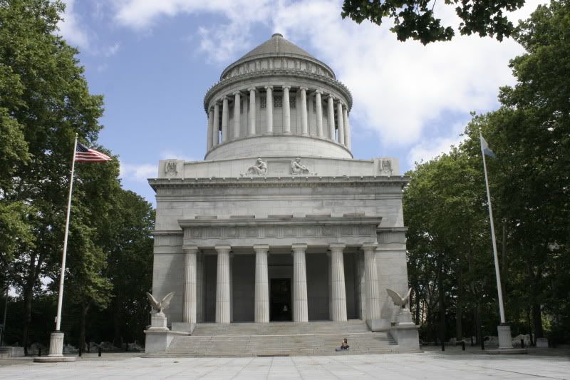
A Civil War hero and America's 18th President, Ulysses S Grant was pretty well-liked among the public - over a million people attended his funeral in 1885. His tomb is the largest tomb in North America - I guess it's like an American pyramid. The national memorial currently houses exhibits in the main room, but an extra pavilion is being built across Riverside Drive to house the exhibits, so that the memorial itself can exist without too much extra distraction. I think this will be a great move, and I'm excited to visit the tomb as it was intended to be: A "simple" monument to Grant and his wife.
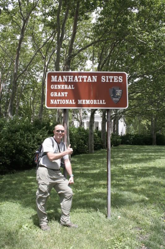
What would a new site be without the thumbs-up from Patrick?
19 more images below the jump.
A Civil War hero and America's 18th President, Ulysses S Grant was pretty well-liked among the public - over a million people attended his funeral in 1885. His tomb is the largest tomb in North America - I guess it's like an American pyramid. The national memorial currently houses exhibits in the main room, but an extra pavilion is being built across Riverside Drive to house the exhibits, so that the memorial itself can exist without too much extra distraction. I think this will be a great move, and I'm excited to visit the tomb as it was intended to be: A "simple" monument to Grant and his wife.

What would a new site be without the thumbs-up from Patrick?

19 more images below the jump.
Pictures 23: Federal Hall National Memorial
Call me daft, but a lot of Revolutionary history is just too distant for me to truly grasp. I have known people who get just as jazzed about Revolutionary history as I would about something that happened yesterday, but I just can't do it. I think part of that may be because much Revolutionary history happened in the Northeast, and so much of the Northeast has changed irrevocably since that time, so it's hard to get a sense of what the landscape was really like back then.
That being said, Federal Hall National Memorial was still cool. It's down in the Financial District, just a stone's throw from the New York Stock Exchange, and is the site of George Washington's oath of office. It also originally housed the first Congress, Supreme Court and Executive Branch offices. Must have been a little crowded.
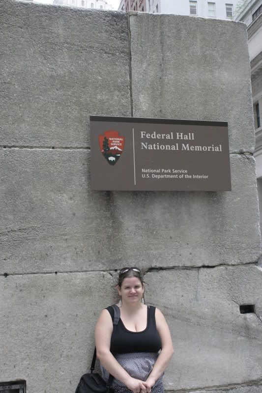
I was here. See? There I am!
7 more images below the jump. Click any one of 'em to make it bigger in Photobucket. Go ahead, click it!
Pictures 22: Theodore Roosevelt Birthplace National Historic Site
There are a few recurring themes that come up as you travel around the Northeast's National Historic Sites and National Monuments, and it's fun to piece them together as you travel along. Franklin Delano Roosevelt has come up a lot (more on him when we get to the Hudson Valley), of course George Washington, and Theodore Roosevelt are three of the big ones.
My first acquaintance with Teddy Roosevelt was at the Theodore Roosevelt Birthplace National Historic Site in Manhattan. Roosevelt (called "Teedie" as a kid) grew up wealthy and weak - he was a small and very unhealthy child, so he often sojourned to the country to help his lungs (he also drank gallons of coffee and smoked cigars when he was about 6 years old onward, but that's another story). As a result, he grew to love the outdoors and became the burly, strong and wilderness-obsessed 26th President that we know him as today.
I really enjoyed this historic site. It is tucked back on 18th Street and blends in seamlessly with the buildings around it - so much so that the rangers there said they have had visitors who tell them, "I've lived on 20th Street my whole life and never knew this was here."
The house had to be entirely reconstructed. Roosevelt lived there until age 14 (that's 1872, for anyone who's keeping track), but after the Roosevelts moved out, the building changed hands many times. It was completely unrecognizable when the Women's Roosevelt Memorial Association acquired it after Roosevelt's death in 1919. Over the years, the organization pieced the house back together by calling relatives and friends, painstakingly tracking down pieces of furniture, decorations and art, and somehow figuring out what wallpaper hung in each room and precisely how each room was laid out.
Now, about 90% of the furnishings are original to the family. The entry level is more like a museum exhibit about Teddy Roosevelt, including memorabilia and a collection of political cartoons, and when you take a tour upstairs you get to see the house itself.
Touring this site was awesome. Since the tour groups are small (there were only 5 people in our group), the site is set up so that you can walk right into the reconstructed rooms - they simply ask, "Don't lean on anything," because most of it is original and, if it's not original, it's probably a just-as-old period piece. There is no Plexiglas, no railings, no velvet ropes. I can understand this layout not working so well for larger tour groups and larger homes, but for this situation it was really great.
Without further ado, here are some images. We visited this site on June 17, 2010.
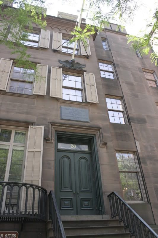
The outside of the building.
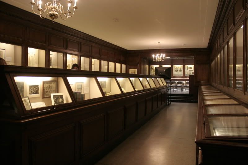
Downstairs - in what would have been the basement/kitchen/servants' area back in the day - is the museum-like exhibit of countless documents and artifacts.
21 more images below the jump...
Wednesday, July 21, 2010
Pictures 21: African Burial Ground National Monument
This was one of the coolest National Monuments we have been to so far. The African Burial Ground National Monument is a memorial to all slaves - more specifically, those kept in Manhattan - more specifically still, those who were buried under the monument's location on Duane Street. The bodies were discovered in 1991, when construction of a federal office building uncovered hundreds of skeletons.
New York City (nee New Amsterdam) was mostly a farming community in the century-ish before the American Revolution. The slaves on those farms were allotted a space in the no-man's land just north of the city proper to bury their dead; the area is believed to span about seven acres in what is now Lower Manhattan, near City Hall. Between construction, the building of the subways and the building of roads, most of the grave sites were obliterated over the centuries.
When the skeletons were discovered in 1991, there was an uproar from the community about how to respectfully deal with the remains - not to mention an uproar from developers who wanted to build on the site. Eventually, a compromise was reached, which included designation of the site as a National Monument and the ceremonial re-burial of the recovered skeletons after archaeological review.
The monument is especially cool because it's so new, I think. The visitors' center is very cool, with tons of information about the history of slavery in New York City. An informational video is re-created with spookily realistic life-sized sculptures of the actors in the film. After studying African-American and post-colonial literature out the wazoo in college, it was really cool to visit this site and increase my knowledge.
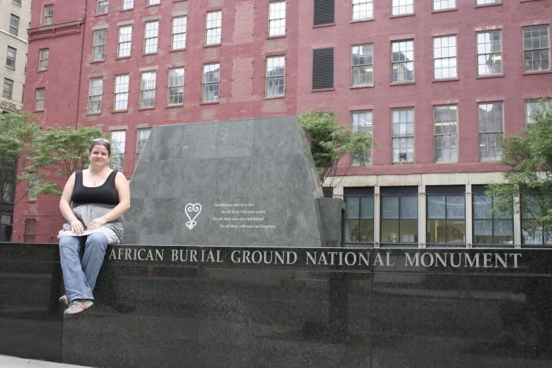
i wuz heer.
Find 9 more images below the jump, including the visitors' center as well as the outdoor memorial.
Pictures 20: Irish Hunger Memorial and Castle Clinton
While tooling around Lower Manhattan, we went to the Irish Hunger Memorial, which my mom first showed me back in May, as well as Castle Clinton National Monument in Battery Park. As you will see, they are two very unique and very different monuments, both of which I liked a lot. We visited these sites on June 16, 2010.
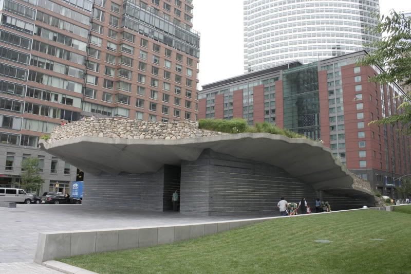
Approaching the Irish Hunger Memorial from the west.
7 more images below the jump. Click any image to see it larger on Photobucket.

Approaching the Irish Hunger Memorial from the west.
7 more images below the jump. Click any image to see it larger on Photobucket.
Pictures 19: World Trade Center
Virtually everyone in America had their own intense experience on September 11, 2001 - some more potent than others. I will never claim to have been deeply personally affected by it, since my concept of "deeply" is based on seeing people whose spouses, children, parents and friends were killed in the attacks. Meanwhile, compared to someone in Idaho, perhaps I could be considered "deeply" personally affected.
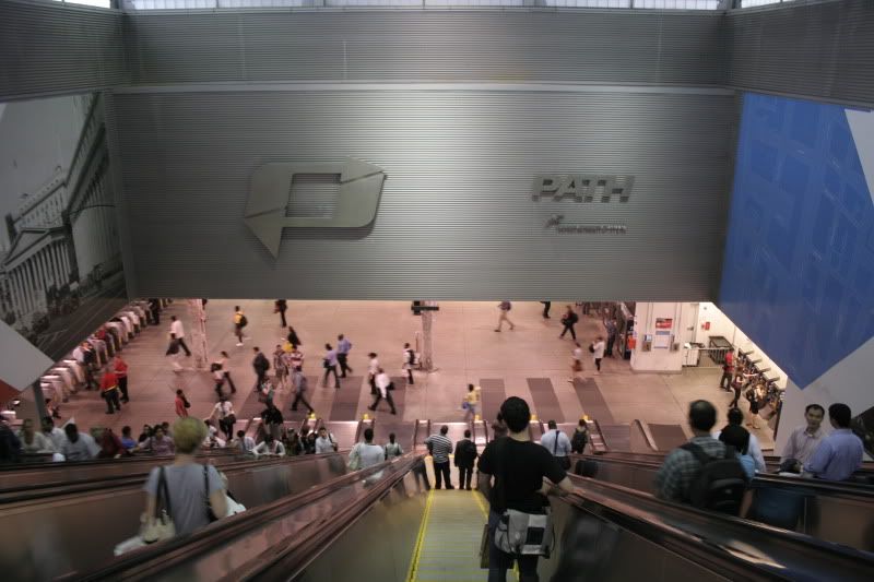
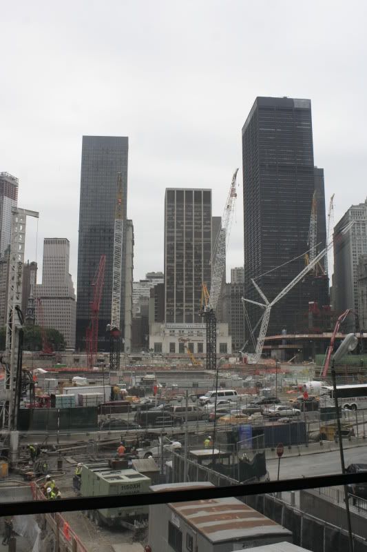
Living in New Jersey - and northern New Jersey, at that - at the time of the attacks automatically made my experience more immediate than the experience of 99% of Americans, and visiting the World Trade Center site and thinking too long about the whole thing is always an unsettling experience.
Having studied creative writing (namely poetry) in what I deem a pretty rigorous undergrad program for five years, I think I have a pretty strong aversion to abstract quasi-patriotic words/concepts like "courage," "bravery," "freedom," "tragedy" and the like - but talking about 9.11 is a strange exception in my literary brain. It's as if I can't use concrete words. I can only refer to that day in terms of abstractions, in terms of words you can't necessarily define - as if to be able to define it would be too painful, too raw.
I don't quite feel like getting into it here, so I'll let some pictures suffice.

The PATH (Port Authority Trans Hudson) station at WTC obviously closed shortly after the attacks and re-opened only a few years ago. Thousands of people use it every day - and I might even say it's my favorite PATH station. Hopefully this image can give you an idea of its size.

The best place to view the "reconstruction" of Ground Zero is in the World Financial Center just west of Ground Zero. You can see they have made a lot of progress. (End sarcasm.) Personally, I think the whole site should just be turned into a simple park, but who am I to decide.
In addition to simply thinking about the attacks, the way the site has turned into a tourist attraction is unsettling as well. I appreciate that people from all over the world want to see where this event took place, but what I cannot forgive is the commodification of what is essentially a graveyard. While Patrick and I looked at the site through the World Financial Center's large glass windows, a woman with a European accent came up to me, asked brassly, "Is this where the attack happened?" and pointed out the window. I said yes, and she then turned to her group of friends and spoke loudly in her native language, gesturing to the scene. It was like she was asking, "Is this where King Kong was?" while pointing at the Empire State Building. I wanted to tell her to shut the hell up. But it wasn't worth it.
In addition to simply thinking about the attacks, the way the site has turned into a tourist attraction is unsettling as well. I appreciate that people from all over the world want to see where this event took place, but what I cannot forgive is the commodification of what is essentially a graveyard. While Patrick and I looked at the site through the World Financial Center's large glass windows, a woman with a European accent came up to me, asked brassly, "Is this where the attack happened?" and pointed out the window. I said yes, and she then turned to her group of friends and spoke loudly in her native language, gesturing to the scene. It was like she was asking, "Is this where King Kong was?" while pointing at the Empire State Building. I wanted to tell her to shut the hell up. But it wasn't worth it.
7 more images below the jump.
Pictures 18: Midtown
June 18 found us wandering Midtown (we spent one day in Lower Manhattan, one day in Midtown and a half a day way up near Grant's Tomb - that photo post is coming later). We skipped most of the touristy stuff for lack of funds (no adventure to the top of the Empire State Building - it's $18 a head to stand in line for three hours! What?!) but did manage to see everything that we could see that was free. And now you can see some of it too.
Click any image to make it bigger in Photobucket.
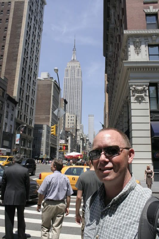
Nerd! Sometimes being a tourist is fun. We lamented that we couldn't go to the top, but then again, if we were inside it, we wouldn't be able to see it, now would we?
17 more images below the jump.
Click any image to make it bigger in Photobucket.

Nerd! Sometimes being a tourist is fun. We lamented that we couldn't go to the top, but then again, if we were inside it, we wouldn't be able to see it, now would we?
17 more images below the jump.
Pictures 17: Summer in the city
Having grown up in New Jersey, I think I'm a little blase to the city - well, I'm kind of blase to any city.
You know how there is always some "big city" of your childhood? Like, if you grow up in Nebraska, maybe it's Omaha, and if you grow up in eastern Washington perhaps it's Spokane, or if you're from Florida it's Tampa. You can be used to going to Omaha or Spokane or Tampa and still be totally blown away when visiting New York. But it's hard to be used to going to New York and be blown away by Omaha or Spokane or Tampa or... anywhere, really. So when New York City is "the city" of your childhood, you're kinda hard to impress sometimes.
That's not to say that I'm city-savvy. I think I was pretty good when I was in high school and during the first half of college, but now that I've lived away for seven years and haven't spent an extended amount of time at home for five of those years, I find myself getting "misplaced" (I prefer to use that word rather than "lost," because I think "lost" connotes hopelessness, whereas "misplaced" implies that I've only gone slightly off-course and will be righted soon) more often than I ever used to.
One thing I can definitely recommend to anyone visiting New York is that you should have a plan. Have places you want to go and know where they are. There is always a time and a place for spontaneity, and I'm hardly saying you should put a chokehold on your schedule, but I've done New York both ways - wandering around aimlessly and going in with an agenda - and personally, I prefer the latter.
It's especially useful in New York because, since the buildings are so tall and there are just so damn many streets, it's very easy to miss what you wanted to see. For example, we had to basically spiral around inward on streets around in order to find the Theodore Roosevelt Birthplace National Historic Site - there's no way we would have found it if we didn't know it was there. Had we just wandered around the city, we certainly would have missed it - and I'm glad we made it there, because it was pretty awesome.
But anyhow, I promised you pictures, so here are some pictures - these were all taken on June 16 (wow, that was a long time ago!). I present you with a random sampling of lower Manhattan before I move on to more specific locales.
Click any image to make it larger in Photobucket.
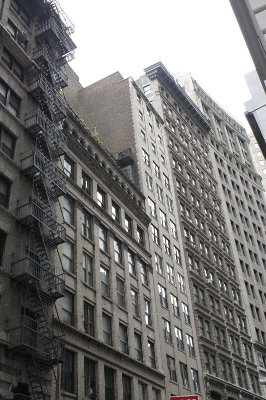
Buildings. I like buildings. This is somewhere down in the Financial District.
17 more images below the jump...
Tuesday, July 20, 2010
They're just things.
There is so much to write about, and before I was getting overwhelmed that I could never, ever possibly catch up. But then I realized that I've been in this predicament before. Last time I got behind was the first time this summer that I went to Pittsburgh, and I solved that problem easily enough by writing about Pittsburgh via pictures, and showing pictures via writing about Pittsburgh. Eventually, then, I will show you pictures from the first three weeks of this trip, and tell you about the trip via pictures. Problem solved! Ta da!
But what I find far more interesting than simply showing you pictures is telling you about all the things we have broken, lost or otherwise destroyed.
LOST
1 pair of earrings. When we stayed a night in Northampton Beach State Park, a great little campground in the Adirondacks, we were tempted to stay a second night. It was just that nice. Our campsite was right on the shore of the Great Scandaga Lake, the park was quiet, the landscape was beautiful, and the people were nice. That night I went to take a shower, and I was wearing a pair of tree earrings I got a few years ago at Santa Fe Hemp. I hung the earrings by poking them through the shower curtain. "I'll probably forget these," I thought to myself. And then I did. I went back the next morning and found the little holes in the shower curtain, but no earrings hanging from them.
1 sock. I pride myself on getting through three years of living in college dorms without ever losing a single sock. Seriously. But then, in the months of October-January 2007-2008, I somehow lost 6 socks from 6 different pairs. As a result, I am truly haunted by the prospect of losing socks. When we stayed with Patrick's uncle in Burlington Flats, New York, we did some laundry, and I lost a sock. RIP yellow and white sock.
1 laptop charger. My laptop is very old - in laptop years, at least. It's a Compaq Presario V2000 that I got in spring 2006, when I spilled coffee in my old(er) laptop during midterms week and had to make an emergency purchase of a new computer. It's still trucking, though, even though the battery only holds about 5 minutes of charge. So when I left my laptop charger at a Wendy's in Rome, New York, discovered I did so in Rochester, New York, and I had some work due to my editor in Santa Fe only a few days later, it was no good. I called my dad, who keeps extras of everything on earth, and he had an extra laptop charger for my computer. He sent it to my brother's house Pittsburgh, where we would be in the next few days, and we went to Best Buy and picked up a replacement charger (for $86!). Once we got the charger from my dad in Pittsburgh, we returned the charger to the Best Buy there. Crisis averted.
BROKEN
1 car radio. On the 4th of July, we were driving to the Jell-O Museum in LeRoy, New York. A super incredibly horrible and obnoxious commercial came on the radio. I freaked out and turned the volume down to nil. And the radio clicked completely off. I thought, whatever, I must have just turned it off. But when I went to turn it back on, it didn't come back on. Not even the clock. Patrick checked the fuses, and they were fine. Everything else on my dashboard works. RIP Radio. (We had my mom send me by battery-powered iPod player from NJ, but of course she couldn't find the power cord. My iPod, which is also from 2006, only holds about 2 hours' worth of charge, so we have to charge it periodically.)
1 external hard drive. My laptop, being 800 years old, doesn't have much storage left, so I have been totally dependent on an external hard drive for a few years now. I have all my images since I started college (August 2003) on my external drive. So you can imagine my confusion when, while we were still in New Jersey, I plugged it in one day to have it just... Not show up on my desktop. We tried plugging it in to my parents' desktop, and it worked - so we thought it was my USB ports. But then we plugged Patrick's phone into my USB port and it showed up fine. I knew I wouldn't be able to empty my camera's memory card unless I somehow got external storage space, so when we went to the Best Buy in Pittsburgh to return my laptop power cord, we stopped by Target to get a Western Digital 320-gig Passport. This is literally smaller than Patrick's wallet, needs no AC power source (like my old hard drive did) and olds nearly 2 times what my old drive did (it held 186 gigs). Plus, it's pink. Needless to say, I'm happy. It had mixed reviews online, but we have been using it for a few weeks now and I couldn't be happier. We didn't want to spend $15 on a case so we keep it in a sock. Meanwhile, I sent my old drive home with my brother for my dad to tinker with.
BROKEN AND RESURRECTED
1 camera. Patrick has an old Nikon digital camera that he's been toting around the country with him, and since my Canon takes better pictures, we have been using my camera for stills and his for videos. When we went to Niagara Falls, we went on the Cave of the Winds tour, which is pretty much the coolest thing ever - you can basically stand under the falling water on the "Hurricane Deck." Naturally, Patrick did, and he wanted me to get some photos and video of him doing so. They call it the Hurricane Deck for a reason - I've never been in a hurricane, but Patrick has, having lived most of his life in Florida, and he said the name is pretty accurate. The camera got completely soaked. Naturally, later that night, it wouldn't turn on. But we left it in the sun for a while that day, apparently dried it off enough, and it turned on again eventually. Soon we'll get that video off the camera and see how awesome (and totally unintelligible) it is.
STILL WORKS (THANK GOD)
Car air conditioner. As I mentioned in my last post, it has been hot as hell pretty much the whole time we've been on the road (it was a little chilly in Burlington Flats, but that's about all the respite we've gotten). If the car air conditioner conks out, I swear to god I am going home. Or just driving north until I hit the arctic circle.
Computer. Sure, I have sucked at blogging, but Facebook has been my link to everyone else in the world to let them know what I'm up to and how we're doing. Not only that, but we have made extensive use of Roadside America, state land bureau websites (to find free or cheap camping) and the like - and once we get to areas where we don't have many friends, we will be using CouchSurfing more (Pat and I both have accounts).
OTHER STATS
Received: 1 speeding ticket (Charlotte in Batavia, New York - we hate Batavia)
Locked in car: 1 car key (Patrick in Batavia, New York - did I mention we hate Batavia?)
Copy made: 1 car key (Henrietta, New York)
There will undoubtedly be more things to add to this type of an entry, but hopefully nothing else vital breaks or goes missing. But if they do, oh well. They're just things, right?
Friday, July 16, 2010
Just another day on the rebound road...
Patrick and I have been on the road for nearly three weeks and I have yet to finish my entries about our NY/NJ adventures from before we left. This is a problem with me and my writing lately (and by "lately" I mean the last 5 or 6 years that I have attempted to re-start a daily journal) - when I get really behind, I find it hard to start up again because I feel like I have missed so much and it's almost a lost cause. I want to be able to record everything, every day, every place we go, everything we do. It's impossible - especially when I am a full month behind, blog-wise.
So I am sitting here in Dexter, Michigan, realizing I have put this off for far too long - and since yesterday was a perfect example of the kind of incredibly strange day I expect to have on the road, I knew I needed to sit down and write about it.
This is what I have skipped blogging, and what I hope to catch up on eventually: wandering around Manhattan, deciding suddenly that we needed to leave (and fast), figuring out precisely how to leave so fast, spending a week in upstate New York from the Hudson Valley to Niagara Falls, a few days in Pittsburgh, a few days in Ohio's Cuyahoga Valley National Park (which I definitely do have to write about; it was a mixed bag, but overall pretty cool), two days or so in Columbus, Ohio, and now Michigan.
So read about yesterday below the jump - which includes (but is not limited to) giant ears of corn, a house-sized fiberglass loaf of bread, Manchester, Michigan's world-famous chicken broil, and a bunch of Christians in a flooded basement.
Saturday, June 26, 2010
Sandy Hook revisited
Much like Morristown National Historical Park, I have been visiting the Sandy Hook area of Gateway National Recreation Area since I was a kid, but never went there specifically for its role in the National Park System. My family used to go down there to swim all the time when my brother and I were kids - there were no gaudy boardwalks and piers to distract us from the ocean (which was probably very convenient, since I was - and perhaps still am - one of those kids who insisted their parents buy them something at every possible opportunity), and it's essentially the northernmost and thus closest expanse of beach along the Jersey shore.
Patrick and I went down on Monday, June 14 - it's generally a good idea to do all of one's shore-visiting on a weekday, because weekends get pretty ridiculous (Pat said that, when he came into New Jersey on June 12, it was the first time he'd ever heard a radio traffic report on a weekend - it was most likely for shore traffic).
Gateway National Recreation Area has sections both in New Jersey and New York; the Sandy Hook unit is the only one in New Jersey, and in New York it has areas on the southern shore of Staten Island and in Jamaica Bay in Brooklyn and Queens. I've never been to either of the New York areas, mostly because they're a pain in the ass to get to. Sorry, New York, but that's just the way it is.
Wednesday, June 23, 2010
The Value of History - Morristown, NJ
The second day of Patrick's visit - the first full day he spent in New Jersey - we decided to waste no time in starting our exploration of New Jersey's participation in the National Parks System. New Jersey only has four sites that are part of the NPS - five if you count the Statue of Liberty (which is considered in New York) - and two of them straddle state lines, so we had some looking around to do.
First on the lineup was Morristown National Historical Park, which I've visited a hundred times before but have never really appreciated as a part of the NPS. My town, Chatham, is right next to Morristown, so as kids we always went on field trips to the area - especially to Jockey Hollow, which is the area where Washington's troops spent their most horrid winter during the American Revolution. We visited the park on Sunday, June 13, which was a slightly cool and overcast day in the morning, but turned into a day of torrential downpour as time went on. But that's later.
First on the lineup was Morristown National Historical Park, which I've visited a hundred times before but have never really appreciated as a part of the NPS. My town, Chatham, is right next to Morristown, so as kids we always went on field trips to the area - especially to Jockey Hollow, which is the area where Washington's troops spent their most horrid winter during the American Revolution. We visited the park on Sunday, June 13, which was a slightly cool and overcast day in the morning, but turned into a day of torrential downpour as time went on. But that's later.
Book excerpt: The Last Three Miles

In that spirit, I'd like to present you with an excerpt from Steven Hart's book, The Last Three Miles: Politics, Murder, and the Construction of America's First Superhighway, a book about the Pulaski Skyway. I started reading it upon coming home, and admittedly I stalled (no pun intended) on page 100 of the 192-page book; it was a little dry for my taste and I couldn't really get into it. I'd be willing to give it another go, however, after rediscovering this passage, which is a truly evocative description of driving from the Holland Tunnel and across the Skyway. (The author is a born-and-bred New Jerseyan.)
Below is the excerpt, in bold.
Subscribe to:
Posts (Atom)